Published on
04:35 GMT
Low-level Flights to Image Geology Over Eastern Oregon
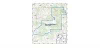
(Map showing the location of the survey (blue polygon) over eastern Oregon | Image courtesy of USGS) Low-level helicopter flights will begin in October over eastern Oregon to image geology using airborne geophysical technology. The flights are a …
Source:
Cascade Business News - Oregon
-
Neutral